KPC-PC-0205
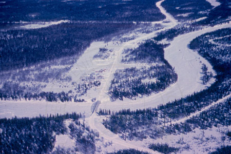
Aerial winter view of Soldotna, late 1950's
Aerial view in winter. Visible in center (paralleling the Sterling Highway) is Soldotna's first airstrip, which was later transformed into a portion of Warehouse Street. The Sterling Highway exits the top right of the photo, and the Kenai Spur Highway exits near the top left. Funny River Road can be seen in the lower right on the near side of the river.
Individuals
Collection
Mullen Collection
Location
Soldotna, Alaska
Date
Late 1950's
Photographer
Al Hershberger
Image Type
color slide
Dimensions
5cm-5cm
Condition
good
Identified By
Marge Mullen
Date Cataloged
11/6/2000
Archive Location
KPC Anthropology Lab
Use Agreement and Restrictions
All of the photographs in this collection are for personal, educational, or research use only. These images cannot be used for political, commercial, or advertising purposes. At the present time the college does not have the capabilities to reproduce prints from the image scans. For technical inquiries, or to report errors, please contact webmaster@alaska.edu.

